Duathlon - 1:51:34 - 2011 Legacy Duathlon - 2nd AG - 17th overall - (Run 5K, Bike 22m, Run 5K)
Short-Term Running Goals:
50K 2011 Buffalo Run!
50 Miler 2011 Pony Express Trail 50
Zion Train
Grand Canyon R2R2R
Long-Term Running Goals:
Just keep swimming...just keep swimming...but running.
Personal:
I'm a happily married guy with a 5 year old son. I started running on February 1st, 2010 with the goal of completing a triathlon (my one and only "official" race prior to that was the "Centerville half mile fun run" when I was about 8) In that following year I lost nearly 50 lbs, completed the triathlon, numerous 5Ks, 10Ks, bike races, and really started to lean towards running over the other two (though I still cross train with both).
I grew up hiking and riding horses in the mountains, so I've been drawn to take my running to the trails - and haven't looked back! I run them every chance I get, which is about 90% of the time!
Draper BST wih Jun. The trail was an array of mud and ice, which made for an interesting time. A good portion of it was just fine, and we were able to make pretty decent time. I tried to keep the pace up and Jun stuck right with me, despite having done Granduer this morning. Took a quick conference call at the halfway mark, and then made our way back. I almost slipped in the mud and then Jun slipped in it right behind me. He was up quickly and we kept on our way. We took a slightly longer route back which would give us over 6.5 and put Jun at 17 miles for the day. The last decent was super fast, sketchy and fun! One of my faster times on this course despite the conditions.
Evening run on the Kaysville BST with Matt VH. I decided to wear spikes this time and they helped considerably. I was feeling pretty good and kept up a decent pace. The moon was bright and it was pretty warm out, even long after the sun had set. I waited for Matt at one point and then forgot to turn my watch back on until about a mile later...son of a. I hate it when I do that. I lost a little bit of motivation to push hard on the way back since I wouldn't have accurate splits, but still enjoyed a fun pace in the snowy downhills.
Jun and I were able to meet up with Seth for a sweet 10+ mile run in St. George in the early am. It was a super fun run with pretty much perfect weather.
Evening run on the Kaysville BST. The trail was a bit of a mess - mud, snow, ice, water...pretty much a little of everything. Lots of super slippery ice, so it was good I had spikes, and plenty of half melted crusty snow to keep you on your toes to keep from falling through. One of my faster times on the course.
View Benchmark with Scott and Jun from the Red Rock trailhead, up Potato Hill to Anns, then up to the top. The trail was a mess of mud and snow, and I really wasn't feelin' it on the way up. Got to the top in 1:01 and then we headed back down. Felt my legs starting to come back as we hit the switchbacks and then turned onto Anns. This time we decided to take Anns south and then just run the road back to the car. Felt super good and just cruised on down - putting a decent gap on the other two. Jun had killed me going up by several minutes, so my real goal was to try and make up that time! :) I forgot my watch so I'm mad I can't see what my splits were coming down.
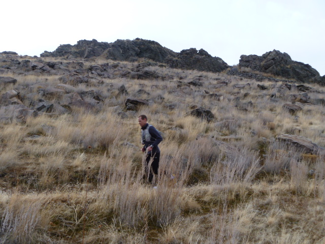
let Jun borrow my spikes the other day, and since he has yet to return them, I decided not to run the BST in Kaysville today. I decided to try out the BST a couple miles south, starting at the mouth of Baer Canyon and heading South to Farmington Canyon. You immediately start with a climb, then once you hit about 5200 feet the trails settles down and rolls you along. About halfway through you get to Shepherd creek, where you have to drop down just to the neighborhood, and then climb your way back up to the same elevation you were before. The lower part was snowy, and had some stairs that were completely covered, which was a little sketchy, there was a rope there, which helped a lot especially on the way down. Got to Farmington Canyon at about 3.3 miles. Didn't go all the way down into it, but got to a nice overlook and then headed back. Was able to run (slowly) most of the climbs, which was good. Trail conditions overall were OK - a few nasty spots and the start/finish but overall well worth running. Will certainly be adding that into my schedule, especially for some climbing days.
6.6 miles - 1:20:42 - 12:12 AP - 1950 vert
This is looking back where I came from at the turnaround point. Back up we go! (You can see trail markers scattered throughout, including on the skyline)
Late afternoon run on the Pipeline Slushee trail. It was a bit of a mess - if it was colder it would have been really bad ice. As it was there was enough slush to provide a little traction, but it did slow you down quite a bit. A few dry spots to even things out, and it was funny to watch how quickly the pace picked up on dry ground with the same effort. Ran 3.3 out and then back. Ran a negative split on the second half. Same distance as yesterday, just 23 minutes faster...interesting what the hills do to the pace! Amazing weather - shorts and 1 shirt.
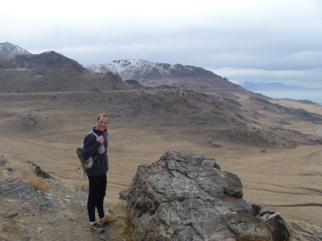
it up the island with Matt VH in preparation for his Buffalo 100 run. We did the west side loop with the Elephant head out and back. Weather was cloudy but nice - shorts and a single long sleeve! Saw a bunch a deer and buffalo, including passing by some that were hanging out rather close to the trail. I wasn't feeling particularly good at first, but as the tightness from the weeks running seemed to get shaken out I started feeling better. Passed a guy riding a bike pulling a pug behind him on a trailer (the pug had run 6 miles, which is pretty solid for a pug!) and it looked super funny, just standing in the back like he was commanding a chariot - wish I would have snapped a pic. They passed me in White Rock valley and then I passed them going up the hill - then my goal was to not let them pass me in the remaining 3 or 4 miles. Finished a couple of minutes ahead of 'em. I don't know what it is with me forgetting my watch lately, but I did it again! Right around 3 hours of running time.
19 miles - 3:00:00 - 9:28 AP - 2250 vert
MattVH coming up out of the valley - Elephant Head in the background
VH Hittin' the switchbacks!
VH Posin' - Elephant Head
Great Salt Lake to the SouthWest
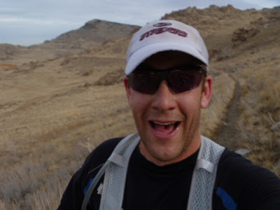
Action shot! Gee I love running! (And apparently I look like a dork when I do it!) :)
BST Baer Canyon South to Farmington. Nice and casual evening run with a couple of good climbs. Didn't push it super hard, just enjoyed the run. Would have been nice to get out earlier, but I still had a great time. Saw a herd of deer with a good sized buck just above me where I turned around.
View Benchmark with Jun by way of Potato Hill to Anns from the Red Rock trailhead. Right from the start the trail was crap - a few inches of fresh snow covering a muddy mess beneath. It was pretty slow going up. Jun put a little gap on me, but I tried to not let it get bigger, and I did pretty good. The steep connector trail off Anns was deeper snow and still slippery mud underneath. At the switchbacks we (Jun) was blazing a new trail in the fresh snow. Slow going. Once we got to the wider road towards the peak we were hoping for more tracked out trails...nope. You'd fall a couple of inches with every step, then as we got further up, that few inches became several inches to a foot. It was nearly impossible to run in some spots. Once we hit the ridge up to the peak, the wind was blasting bitter cold, where below it had been sauna hot. Hit the peak and spent just a minute up there and then blasted our way back down. It was super fun, but super sketchy at the same time. You never knew what each footfall will give you - you might find immediate purchase, or find your foot sinking knee deep in snow. We were moving fast and at least gravity helped pull us down. When we got down towards Anns and to warmer weather, the trail just got worse and worse - we were just slip, sliding everywhere. The weirdest part was that your eyes see snow, but your feet feel mud. When we connected up with the BST we decided we'd had enough of ripping the trail apart, so we jumped off the trail and onto the road and ran the last little bit back to the car. 9.6 miles but my legs were saying more like 16...Thats what we call brutally fun...:)
Dimple Dell with Jun. Kept it fairly casual, but still a decent pace and, as it turns out a full min/mile faster for me than the last time I ran this. Feeling much better these days. Jun and I had a nice little sprint at the end, where I beat him by a coupla seconds. Could have something to do with me taking yesterday off and him climbing two peaks....Nah, couldn't be it.
"The Wedge" with Jun, Scott and
MattVH. Jun threw the idea out just a few days before and we were all able to
get our schedules worked out to make it happen. I remembered reading Crockett's
report about this run, so I was really excited to get out there and give it a go.
I picked up Jun in early morning, and we drove
down to AF and met Matt & Scott, where we all piled into my car and headed
on out. As we got close to the starting point, we took a very slight detour to
put in a drop bag for an aid stop, and then drove the couple miles to the
start point. The road drives you straight up to the edge of the Little Grand
Canyon, so it makes for a spectacularly welcoming view. Almost as nice was the
presence of a bathroom at this point, which a few of us took advantage of.
Once we were all changed
and had snapped a few pre-run pics, we set out - stopping again within about a
half mile at the Wedge overlook, where we took a few more pictures and took in
the views. Shortly after the overlook, we were off the dirt road and onto the
winding singletrack that would be our constant companion for the next 30 or so
miles. The trail winds back and forth and all around the various fingers of the
Good Water Canyon. Aside from the rough terrain and constantly winding trail,
one of the truly challenging aspects of this course is how brutally close your
path winds back and forth near where you just were - sometimes with a massive
gorge between the two points, other times not as much. It's really cool to look
just across the way and think that even though it's only a couple hundred yards
away, it will be a mile or two before you reach that point. Cool at first, but
certainly a little more challenging the longer you have been running on
it...and to just tease you a little more, there is a road that connects the
start to finish that's all of about 5 miles long (thats taking us 15) that you
can almost at any point, easily bail out onto and run back.
We stuck mostly together
to the drop spot at mile 8.5 (2 or less if by road:)) where we wouldn't stop
now, but would on the way back. From there we began to spread out a bit more. I
hung with Jun for a while, and he was cooking along pretty well, so I pulled
back a little while him and VH put a gap on me. Shortly before the turnaround,
Jun passed me on his way back, and when I got there I couldn't see VH, so I
wasn't sure if he was just takin' care of bidness or what (turns out he was
taking in the scenery at the edge of the point). I quickly turned back, but
spent a couple of minutes walking and eating a sandwich I had stashed in my bag
(gotta love the Uncrustables, they're perfect for stuff like this). Then picked
up the pace and ran into Scott a bit later. He was moving along, but mentioned
he had been dealing with stomach issues. I directed him to VH - who, as the
most experienced in that area of the bunch - would hopefully be able to help
him out with that.
From there I hit a bit
of a low, I didn't really feel like I was bonking or anything, but just didn't
feel like I could push the pace very well and found myself running very slowly.
I kept hearing footsteps behind me and would turn, expecting to see the boys
coming up on the trail, but every time I turned there was no one there (weird
how that happens). I took care of my own business at mile 21, which greatly
helped the way I felt. At mile 22.5, where the drop bag was, I took a minute
and downed a Pepsi, rearranged my bag (threw a gel or two up front) and then
headed out. By this point my hip (sciatic?) was feeing really tight, especially
when I walked, which I guess was good because it gave me motivation to keep
running. I had also tied one of my shoes way too tight (it had come undone on
the trail) and I was starting to feel that nasty pain on the top of my foot
and, rather than do the smart thing and take 10 seconds to loosen the laces a
little, I just kept on a goin'. The last few miles were especially tough, the
trail just playing mind games with you as you keep winding, and even coming
within feet of a road. At one point our tracks hit the road from where we came
from, but I followed Juns tracks continuing on the trail, which was really
cool. Once that trail merges with another road, I lost Juns tracks and I just
stayed on the trail, which took me to a 'dead end' -which was an overlook,
which was an awesome view, but at mile 30.5 I was ready to be done, so I could
see where I needed to go and took off. Once I hit the road that I knew would
take me to the car I really pushed the pace. It was an uphill run, which didn't
seem to end. I didn't remember the road being this long, or being a downhill
this morning!! As I neared the car I could see Craig huddled behind a rock,
waiting patiently for me, the key holder, to show. Why we don't just designate
him as the car key carrier still baffles me. You'd think he'd just start asking
to carry it. Felt good to change clothes and get into something warm
(temps were fine as long as you were moving - once you stopped though, it got
cold!), and I downed a couple of Pepsis as we waited for the other fellas to
finish up.
What an amazing run and
well worth the drive to run, or even just look at, any part of that course! It
has so many access points you could really run almost any distance you wanted
and still be able to really enjoy it. Can't wait to get back out there again.
I wore my Contour
camera, so I'll try and throw together a little compilation video of the run
here soon.
I decided to do a nice casual run with some vert to give the legs a workout but not worry about a bunch of miles. Started at Baer canyon and went south on the BST, this time though, I decided to explore around a little and have some fun. At Shepherd Creek instead of going down to the neighborhood, I searched around and found a VERY faint and untraveled trail that went up the canyon a little and then crossed the stream and took you up a more well defined trail that I had been able to see from the other side. Not as easy as going the other way (in the sense of the trails condition) but it reduces the vert a bit. You still have a bit of a climb from there, but then where the BST levels out again, I decided to take another side trail that takes you up a ridge. As I was climbing this trail I saw a herd of about 20 deer just below me scatter and take off to the south. I really had fun just cruising up the steep hill and not really caring about being in a rush or anything. At the high point where I turned around the trail did keep going, but it was pretty icy, so I'll have to save that for spring or when I want to pack some spikes. It's always fun to see where stuff goes.
Overall the trail was in great shape other than a couple of really icy spots, especially up on the ridge. On the way back I took my time and went a little nuts with the camera - the sunset was just amazing! A hair over 4.5 miles with about 1300 feet of climbing.
Some of the fleeing deer
Looking back at the ridge I climbed (on left). You can see the trail starting on the right side, then it crosses over the top of the rocks and goes up the spine on the left side. I went up a little ways past the upper rocks.