After promising myself the entire week off after the Buffalo Run, the weather was looking so nice that I figured that Saturday counted as a week. We had driven to Fillmore last night to visit family, so I set my alarm to get up early and try to knock a run out. We had stayed up late talking, so I set the alarm a little later to 6:30, then when it went off, I told myself that I'd wait till the sun came up and it warmed up a little - then I noticed that my phone said it was 65 degrees out...65 at 6:30?! I hopped out of bed and quickly got dressed. I knew the general area that I wanted to run in, but wasn't sure what trails there were, so I just headed up Chalk Creek Road, which is kind a mix of paved/dirt road for a couple of miles, as it runs right next to the creek. There were a couple of turn offs that went across the creek, and after a while of running on pavement I ran back to one and crossed the stream, only to hit a "No Trespassing" sign about 20 yards later. So, back across the icy stream and back up the road. The road I was on connected to a more established dirt road, then a bridge and a sign. One trail continued up next to the creek, the other took a climb up the side of the hill, towards the hieroglyphics, so I guess I wanted to climb a little, because that's where I headed. After a brief climb, the road forked again, and I took the road towards the hieroglyphics, which was a gradual downhill for about a quarter mile, where it ended. Just off the road to the east was a small cave, and in the morning light I was a little hesitant to go running right up to it, but made my way up to it and I could see the hieroglyphics, which were on a rock face just above the entrance. 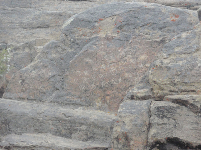
I wasn't sure if I was looking at the right things or if the 'real ones' were in the cave, but after looking around in there I figured that those must be them. Spent a couple of minutes poking around and then headed back out. (Once I got back I was curious as to the history of the signs-one man believed it was directions on finding a buried chamber with gold plates - and spent years and lost lives digging for it, while another describes it more likely as being Indian writings from the 1800's-www.mysteryglyphs.com). 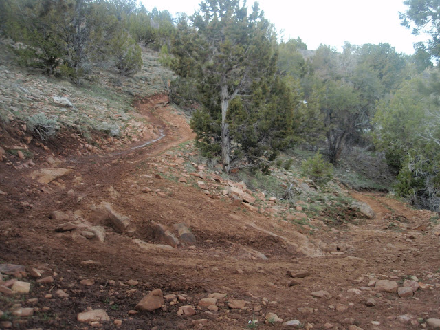
Going Up!
Once I got back to the fork where I had turned down, I kept going up, and continued on a fairly steep climb for about two miles. I was now on an ATV trail, where in the very steepest spots they had put sections of cinder blocks to help get traction when the red dirt turns to slippery mud. 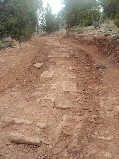 It was a beautiful morning, I was heading east towards the mountain top, so I was chasing the sun back, staying in the shadow of the mountain. The trail then opened up into a wide flat area and, judging by the earlier signs, I think I was at White Sage Flats. Ran to the end of the flat where the trail split, one going up further, and one heading back down towards the creek. As much as I wanted to explore either one, I thought it would be best to start heading back. 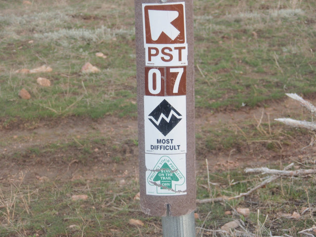 Where I had stopped there was a small sign pointing to where I had come
from (and where I was heading back) that said "Most Difficult" - I
wondered if it was most difficult for an ATV, what does that make it for
running? :) Had a nice run back down, navigating the rocky terrain. Made it down in nearly half the time it took to get up! Only saw one person the entire time, and that was when I was back down on the paved part. Took this run super easy, wasn't a recovery run, not really a training run, more like a fun run! Left the clock running. 
11 miles - 2 hours - 10 min pace - 1500 ft vert (which was all in 2 miles) Once I got back home we ate breakfast then my wife and I went out for a couple of slow and easy laps around 'the block' for another 2 miles - gotta love the country. :) Looking forward to checking out some more trails when we go down there again.
| 